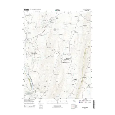
2014 Map of Keedysville
USGS Topo · Published 2014About this map
Antietam National Battlefield dominates the western portion of this topographic survey, preserving the landscape of one of the Civil War's most pivotal moments. Historic landmarks such as The Cornfield Ave, Mumma Cem, and Snavelys Ford are meticulously documented, offering a detailed spatial record of the conflict's geography. To the east, the terrain rises toward Elk Ridge and Blue Ridge, where the residential patterns of Rohrersville, Keedysville, and Burkittsville appear against the backdrop of gaps and springs.
Find a feature on this map
156 named features on this map. Tap any name to fly to it.
Don’t see what you’re looking for? This feature index may not catch every label — zoom into the map to look around manually.
Map Details
Editions of this 2014 Keedysville Map
This is the sole edition of this map. No revisions or reprints were ever made.
Other maps of this area

1884 · Harpers Ferry
USGS Topo · 1:125,000

1891 · Harpers Ferry
USGS Topo · 1:125,000

1893 · Harpers Ferry
USGS Topo · 1:125,000

1908 · Middletown
USGS Topo · 1:48,000

1909 · Hagerstown
USGS Topo · 1:48,000

1910 · Antietam
USGS Topo · 1:62,500

1912 · Hagerstown
USGS Topo · 1:62,500

1912 · Williamsport
USGS Topo · 1:62,500

1914 · Martinsburg
USGS Topo · 1:48,000

1916 · Martinsburg
USGS Topo · 1:62,500