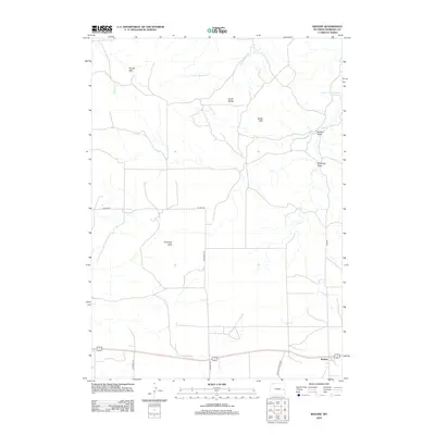
2012 Map of Keeline
USGS Topo · Published 2012About this map
Keeline serves as the primary settlement hub along the southern edge of this Niobrara County landscape, positioned where the high plains transition into a complex network of draws and buttes. The terrain is defined by dramatic geological markers such as Chimney Rock and the Chalk Buttes, while water management is evident at the Lance Creek Number 2 Reservoir. A network of rural arteries, including Windmill Rd and Spanish Diggings Rd, facilitates movement across the ranching country, connecting the southern corridor to the northern Harney Hills. The drainage patterns of Lance Cr and Little Lightning Cr dictate the local topography, carving out features like Sothman Draw and Golden Draw that provide critical water sources in an otherwise arid environment.
Find a feature on this map
18 named features on this map. Tap any name to fly to it.
Don’t see what you’re looking for? This feature index may not catch every label — zoom into the map to look around manually.
Map Details
Editions of this 2012 Keeline Map
This is the sole edition of this map. No revisions or reprints were ever made.
Other maps of this area

1950 · Amend Ranch
USGS Topo · 1:24,000

1950 · Prairie View School
USGS Topo · 1:24,000

1954 · Torrington
USGS Topo · 1:250,000

1958 · Torrington
USGS Topo · 1:250,000

1970 · Lost Springs
USGS Topo · 1:24,000

1970 · Lost Springs NW
USGS Topo · 1:24,000

1970 · Cooley Draw
USGS Topo · 1:24,000

1970 · Keeline
USGS Topo · 1:24,000

1974 · Lone Tree Hill
USGS Topo · 1:24,000

1981 · Bills Creek
USGS Topo · 1:24,000