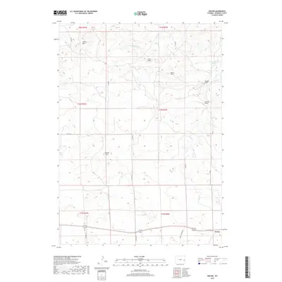
2018 Map of Keeline
USGS Topo · Published 2018About this map
Keeline serves as the primary point of settlement in this landscape of Niobrara County, situated along the southern edge of the survey. The topography is defined by distinct landmarks such as the Harney Hills and Butler Hills, while the prominent geological formation at Chimney Rock provides a clear orientation point for the surrounding plains. To the north, the terrain is carved by the Little Lightning Cr and the drainage of Lance Cr, leading toward the Lance Cr Number 2 Reservoir. A network of rural routes, including the historically evocative Spanish Diggings Rd and Windmill Rd, suggests a region deeply tied to ranching and local resource extraction. The presence of named features like Golden Draw and Sothman Draw underscores the importance of watershed geography in this high-plains environment.
Find a feature on this map
24 named features on this map. Tap any name to fly to it.
Don’t see what you’re looking for? This feature index may not catch every label — zoom into the map to look around manually.
Map Details
Editions of this 2018 Keeline Map
This is the sole edition of this map. No revisions or reprints were ever made.
Other maps of this area

1950 · Amend Ranch
USGS Topo · 1:24,000

1950 · Prairie View School
USGS Topo · 1:24,000

1954 · Torrington
USGS Topo · 1:250,000

1958 · Torrington
USGS Topo · 1:250,000

1970 · Lost Springs
USGS Topo · 1:24,000

1970 · Lost Springs NW
USGS Topo · 1:24,000

1970 · Cooley Draw
USGS Topo · 1:24,000

1970 · Keeline
USGS Topo · 1:24,000

1974 · Lone Tree Hill
USGS Topo · 1:24,000

1981 · Bills Creek
USGS Topo · 1:24,000