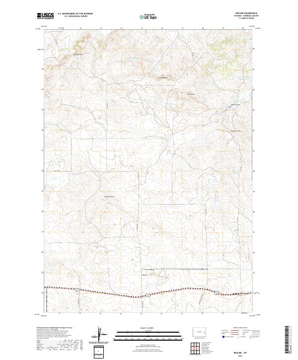
2021 Map of Keeline
USGS Topo · Published 2021About this map
Keeline serves as the primary anchor in this high-plains landscape, situated along the southern edge of a terrain defined by subtle ridges and expansive draws. The geography is marked by distinctive formations like Chimney Rock and the Chalk Buttes, providing essential landmarks in an area dominated by dry drainage systems. Water features are sparse but significant, including Little Lightning Cr and the Lance Cr Number 2 Reservoir, which likely support the ranching operations suggested by the network of local roads like N Mahnke Rd and Windmill Rd.
Find a feature on this map
24 named features on this map. Tap any name to fly to it.
Don’t see what you’re looking for? This feature index may not catch every label — zoom into the map to look around manually.
Map Details
Editions of this 2021 Keeline Map
This is the sole edition of this map. No revisions or reprints were ever made.
Other maps of this area

1950 · Amend Ranch
USGS Topo · 1:24,000

1950 · Prairie View School
USGS Topo · 1:24,000

1954 · Torrington
USGS Topo · 1:250,000

1958 · Torrington
USGS Topo · 1:250,000

1970 · Lost Springs
USGS Topo · 1:24,000

1970 · Lost Springs NW
USGS Topo · 1:24,000

1970 · Cooley Draw
USGS Topo · 1:24,000

1970 · Keeline
USGS Topo · 1:24,000

1974 · Lone Tree Hill
USGS Topo · 1:24,000

1981 · Bills Creek
USGS Topo · 1:24,000