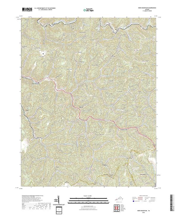
2022 Map of Keen Mountain
USGS Topo · Published 2022About this map
Levisa Fork carves through the center of this mountain landscape, which is defined by a dense network of hollows and ridges at the junction of Buchanan and Tazewell counties. The settlement pattern follows the narrow valley floors, with small communities like Marvin and Grimsleyville situated along Riverside Dr. The topography is significantly characterized by the Sandy Ridge Tennessee Valley Divide in the south, a major hydrological boundary that separates the regional watersheds. Local family history is rooted in sites like Ward Cem near Pilgrim Knob and the various gaps that served as historic transit points between ridges, such as Pistol Gap and Low Gap. The map also traces the industrial and residential corridors of Keen Mountain and Page, where the terrain dictates a linear arrangement of development constrained by the steep slopes of Davis Mtn and Honaker Ridge.
Find a feature on this map
83 named features on this map. Tap any name to fly to it.
Don’t see what you’re looking for? This feature index may not catch every label — zoom into the map to look around manually.
Map Details
Editions of this 2022 Keen Mountain Map
This is the sole edition of this map. No revisions or reprints were ever made.
Other maps of this area

1886 · Grundy
USGS Topo · 1:125,000

1890 · Grundy
USGS Topo · 1:125,000

1891 · Tazewell
USGS Topo · 1:125,000

1892 · Grundy
USGS Topo · 1:125,000

1895 · Tazewell
USGS Topo · 1:125,000

1897 · Tazewell
USGS Topo · 1:125,000

1910 · Iaeger
USGS Topo · 1:48,000

1912 · Iaeger
USGS Topo · 1:62,500

1914 · Bucu
USGS Topo · 1:48,000

1914 · Iaeger
USGS Topo · 1:48,000