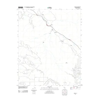
2012 Map of Keene
USGS Topo · Published 2012About this map
Tehachapi Cr carves a critical path through this Kern County landscape, shaping the transport corridor that links the settlements of Keene, Woodford, and Walong. This 2012 topographic study reveals the intricate engineering of the railroad as it winds toward The Loop, a world-famous feat of civil engineering designed to gain elevation in the steep terrain. The map captures a mix of traditional ranching and contemporary residential growth, shown through the network of winding roads like Keene Ranch Rd and the development of Crofton Ranch. From the higher elevations of Black Mountain to the depths of Keller Valley, the terrain dictates the positioning of local landmarks including the Stonybrook Retreat and the Post Office at El Rita. Watercourses such as Water Canyon Cr and Tweedy Cr feed into the central drainage, highlighting the watershed's role in supporting these mountain communities.
Find a feature on this map
101 named features on this map. Tap any name to fly to it.
Don’t see what you’re looking for? This feature index may not catch every label — zoom into the map to look around manually.
Map Details
Editions of this 2012 Keene Map
This is the sole edition of this map. No revisions or reprints were ever made.
Other maps of this area

1914 · Caliente
USGS Topo · 1:125,000

1915 · Mojave
USGS Topo · 1:125,000

1929 · Bena
USGS Topo · 1:31,680

1930 · Bear Mountain
USGS Topo · 1:31,680

1932 · Bena
USGS Topo · 1:31,680

1933 · Bear Mountain
USGS Topo · 1:31,680

1943 · Tehachapi
USGS Topo · 1:62,500

1943 · Emerald Mtn
USGS Topo · 1:62,500

1943 · Cummings Mountain
USGS Topo · 1:62,500

1943 · Breckenridge Mountain
USGS Topo · 1:62,500