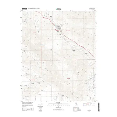
2015 Map of Keene
USGS Topo · Published 2015About this map
The Cesar E Chavez National Monument sits at the heart of this landscape, marking the historic headquarters of the United Farm Workers in the community of Keene. The terrain is defined by the steep elevation changes of the Tehachapi Mountains, where the railway route creates a dramatic serpentine path through Woodford, Walong, and Marcel. This engineering feat allows trains to navigate the significant grades between the Tehachapi Valley and the San Joaquin Valley floor. Small settlements and residential enclaves such as Bear Valley and Rowen are tucked into the valleys and canyons, while agricultural signatures are evident in Cummings Valley and Brite Valley. Watercourses like Tehachapi Cr and Clear Cr drain the high country, following the natural folds of the land near Sycamore Canyon and Oregano Canyon.
Find a feature on this map
86 named features on this map. Tap any name to fly to it.
Don’t see what you’re looking for? This feature index may not catch every label — zoom into the map to look around manually.
Map Details
Editions of this 2015 Keene Map
This is the sole edition of this map. No revisions or reprints were ever made.
Other maps of this area

1914 · Caliente
USGS Topo · 1:125,000

1915 · Mojave
USGS Topo · 1:125,000

1929 · Bena
USGS Topo · 1:31,680

1930 · Bear Mountain
USGS Topo · 1:31,680

1932 · Bena
USGS Topo · 1:31,680

1933 · Bear Mountain
USGS Topo · 1:31,680

1943 · Tehachapi
USGS Topo · 1:62,500

1943 · Emerald Mtn
USGS Topo · 1:62,500

1943 · Cummings Mountain
USGS Topo · 1:62,500

1943 · Breckenridge Mountain
USGS Topo · 1:62,500