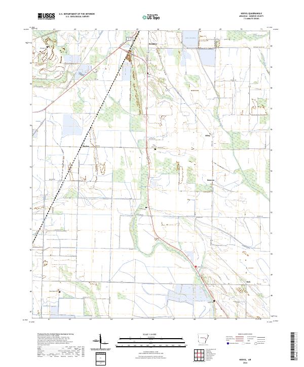
2024 Map of Keevil
USGS Topo · Published 2024About this map
Brinkley serves as the primary hub in this Monroe County landscape, where the intersection of S Main St and Old Town Rd marks a historic nexus of travel and commerce. The surrounding Delta terrain is defined by a dense network of watercourses and rural corridors, with Lake Greenlee and Cypress Creek anchoring the hydrologic system. For genealogists and local historians, the area is notably rich in family and community burial grounds, ranging from Fitzhugh Cem in the northwest to Upper Cem in the south. Small settlements like Alfrey, Emmons, and Bayless are connected by well-established routes such as Mopac Rd and Chicken Farm Rd. The map illustrates a classic agricultural and riparian layout, with named features like Maple Slough and Big Piney Creek indicating the bottomland character of the eastern Arkansas territory.
Find a feature on this map
50 named features on this map. Tap any name to fly to it.
Don’t see what you’re looking for? This feature index may not catch every label — zoom into the map to look around manually.
Map Details
Editions of this 2024 Keevil Map
This is the sole edition of this map. No revisions or reprints were ever made.
Other maps of this area

1935 · Clarendon
USGS Topo · 1:62,500

1940 · Holly Grove
USGS Topo · 1:62,500

1940 · Brinkley
USGS Topo · 1:62,500

1941 · De Valls Bluff
USGS Topo · 1:62,500

1941 · Clarendon
USGS Topo · 1:62,500

1948 · Helena
USGS Topo · 1:250,000

1950 · Helena
USGS Topo · 1:250,000

1955 · Helena
USGS Topo · 1:250,000
1957 · Clarendon
USGS Topo · 1:62,500

1957 · Holly Grove
USGS Topo · 1:62,500