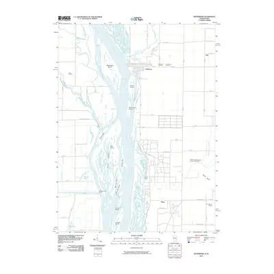
2010 Map of Keithsburg
USGS Topo · Published 2010About this map
The Mississippi River dominates this landscape at the border of Illinois and Iowa, creating a complex network of chutes and sloughs. Keithsburg serves as the primary settlement on the Illinois side, surrounded by local landmarks like the Keithsburg Cemetery and Saint Mary's Cemetery. The river's dynamic nature is evidenced by numerous landforms such as Blackhawk Island, Willow Bar Island, and the Kingston Bar, alongside smaller settlements like Ogle and Milroy.
Find a feature on this map
81 named features on this map. Tap any name to fly to it.
Don’t see what you’re looking for? This feature index may not catch every label — zoom into the map to look around manually.
Map Details
Editions of this 2010 Keithsburg Map
This is the sole edition of this map. No revisions or reprints were ever made.
Other maps of this area

1934 · Oquawka
USGS Topo · 1:48,000

1934 · Burlington
USGS Topo · 1:48,000

1935 · Keithsburg
USGS Topo · 1:48,000

1940 · Oquawka
USGS Topo · 1:62,500

1940 · Burlington
USGS Topo · 1:62,500

1941 · Keithsburg
USGS Topo · 1:62,500

1946 · Wapello
USGS Topo · 1:62,500

1949 · Wapello
USGS Topo · 1:62,500

1953 · Toolesboro
USGS Topo · 1:24,000
1953 · Joy
USGS Topo · 1:24,000