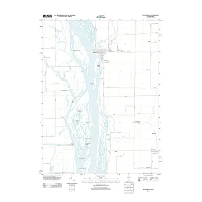
2012 Map of Keithsburg
USGS Topo · Published 2012About this map
The Mississippi River defines the western edge of this 2012 survey, its main channel braided with numerous islands and side-channels including Huron Chute, Cody Chute, and Mapes Chute. The town of Keithsburg sits at the confluence with Pope Cr, showing a traditional street grid featuring Main St and Washington St. This riverine landscape is rich with distinct islands like Big Cody Island, Blackhawk Island, and Johnson Island, separated by intricate waterways such as Gun Chute and Ziegler Slough.
Find a feature on this map
100 named features on this map. Tap any name to fly to it.
Don’t see what you’re looking for? This feature index may not catch every label — zoom into the map to look around manually.
Map Details
Editions of this 2012 Keithsburg Map
This is the sole edition of this map. No revisions or reprints were ever made.
Other maps of this area

1934 · Oquawka
USGS Topo · 1:48,000

1934 · Burlington
USGS Topo · 1:48,000

1935 · Keithsburg
USGS Topo · 1:48,000

1940 · Oquawka
USGS Topo · 1:62,500

1940 · Burlington
USGS Topo · 1:62,500

1941 · Keithsburg
USGS Topo · 1:62,500

1946 · Wapello
USGS Topo · 1:62,500

1949 · Wapello
USGS Topo · 1:62,500

1953 · Toolesboro
USGS Topo · 1:24,000
1953 · Joy
USGS Topo · 1:24,000