
1973 Map of Kelford
USGS Topo · Published 1977About this map
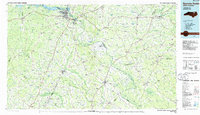
The agricultural landscape of Bertie County is centered around the towns of Kelford and Roxobel in this 1970s survey. The Seaboard Coast Line railroad creates a diagonal axis through the territory, linking these rural hubs and facilitating the regional peanut economy, evidenced by the Peanut Belt Research Station near Lewiston. This era represents a period of consolidated rural education, shown by the Roxobel-Kelford Sch and West Bertie Sch, while numerous unnamed cemeteries (marked as Cem) are scattered across family farmlands and churchyards like those of Beautiful Zion Ch and Luella Ch. The drainage patterns of the Cashie River and Walton Swamp dominate the lower elevations, while several Sandpit sites indicate local mineral extraction. The map also captures the jurisdictional meeting point where Hertford Co and Northampton Co borders intersect.
Find a feature on this map
23 named features on this map. Tap any name to fly to it.
Don’t see what you’re looking for? This feature index may not catch every label — zoom into the map to look around manually.
Map Details
Editions of this 1973 Kelford Map
This is the sole edition of this map. No revisions or reprints were ever made.
Other maps of this area

1953 · Norfolk
USGS Topo · 1:250,000

1962 · Palmyra
USGS Topo · 1:24,000

1962 · Norfleet
USGS Topo · 1:24,000

1972 · Republican
USGS Topo · 1:24,000

1972 · Woodville
USGS Topo · 1:24,000

1972 · Aulander
USGS Topo · 1:24,000

1974 · Rich Square
USGS Topo · 1:24,000

1977 · Union
USGS Topo · 1:24,000

1977 · Woodland
USGS Topo · 1:24,000
1985 · Roanoke Rapids
USGS Topo · 1:100,000