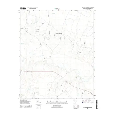
2014 Map of Kellehan Crossroads
USGS Topo · Published 2014About this map
Kellehan Crossroads and Millwood anchor this 2014 survey of Williamsburg County, South Carolina, a landscape defined by an intricate network of waterways and swampy lowlands. The Black River winds through the center of the sheet, joined by numerous tributaries including Spring Gully, Jumping Run, and Gumtree Br. The geography is characterized by low-lying wetlands such as Dry Swamp, Camden Swamp, and Ox Swamp, which have historically shaped the settlement patterns and road networks of the coastal plain.
Find a feature on this map
62 named features on this map. Tap any name to fly to it.
Don’t see what you’re looking for? This feature index may not catch every label — zoom into the map to look around manually.
Map Details
Editions of this 2014 Kellehan Crossroads Map
This is the sole edition of this map. No revisions or reprints were ever made.
Other maps of this area

1943 · Trio
USGS Topo · 1:24,000

1943 · Andrews
USGS Topo · 1:24,000

1943 · Bonneau
USGS Topo · 1:62,500

1946 · Kingstree
USGS Topo · 1:62,500

1946 · Indiantown
USGS Topo · 1:62,500

1949 · Georgetown
USGS Topo · 1:250,000

1967 · Georgetown
USGS Topo · 1:250,000

1974 · Georgetown
USGS Topo · 1:250,000

1986 · Georgetown
USGS Topo · 1:100,000

1986 · Kingstree
USGS Topo · 1:100,000