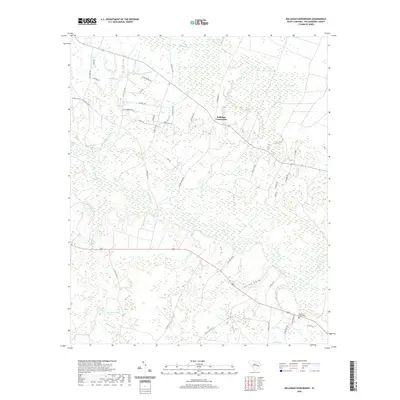
2020 Map of Kellehan Crossroads
USGS Topo · Published 2020About this map
The Black River winds through the heart of this Williamsburg County landscape, defining a terrain shaped by extensive wetlands and traditional Lowcountry watercourses. Central to the map is the intersection at Kellehan Crossroads, a focal point for a network of rural routes named for local families, including Alice McCrea Rd, Lela Harrison Rd, and Doc Kellahan Rd. The hydrology of the area is exceptionally detailed, featuring complex drainages such as The Morass, Dry Swamp, and Camden Swamp, alongside smaller tributaries like Spring Br and Gumtree Br. For those tracing local history, the Spring Gully Cem stands as a primary genealogical landmark near the southern reaches of Spring Gully. The map illustrates a region where land use is dictated by the water, from the basin of Parsons Pond to the distinct natural depressions of Cedar Bay.
Find a feature on this map
49 named features on this map. Tap any name to fly to it.
Don’t see what you’re looking for? This feature index may not catch every label — zoom into the map to look around manually.
Map Details
Editions of this 2020 Kellehan Crossroads Map
This is the sole edition of this map. No revisions or reprints were ever made.
Other maps of this area

1943 · Trio
USGS Topo · 1:24,000

1943 · Andrews
USGS Topo · 1:24,000

1943 · Bonneau
USGS Topo · 1:62,500

1946 · Kingstree
USGS Topo · 1:62,500

1946 · Indiantown
USGS Topo · 1:62,500

1949 · Georgetown
USGS Topo · 1:250,000

1967 · Georgetown
USGS Topo · 1:250,000

1974 · Georgetown
USGS Topo · 1:250,000

1986 · Georgetown
USGS Topo · 1:100,000

1986 · Kingstree
USGS Topo · 1:100,000