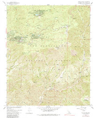
1967 Map of Keller Peak
USGS Topo · Published 1985About this map
Green Valley Lake and the neighboring resort communities of Running Springs and Arrowbear Lake anchor this mid-century survey of the San Bernardino Mountains. The map reveals a landscape defined by seasonal recreation and youth camps, including the Hollywood Boys Club, Helendale Reservation, and Camp Wintaka. This concentration of campgrounds and mountain retreats highlights the era's focus on alpine tourism and organized youth recreation within the San Bernardino National Forest.
Find a feature on this map
68 named features on this map. Tap any name to fly to it.
Don’t see what you’re looking for? This feature index may not catch every label — zoom into the map to look around manually.
Map Details
Editions of this 1967 Keller Peak Map
3 editions found
Other maps of this area

1899 · Redlands
USGS Topo · 1:62,500

1901 · Southern California Sheet No. 1
USGS Topo · 1:250,000

1901 · Redlands
USGS Topo · 1:62,500

1902 · Deep Creek
USGS Topo · 1:62,500

1902 · San Gorgonio
USGS Topo · 1:125,000

1904 · Southern California Sheet No. 1
USGS Topo · 1:250,000

1947 · Lucerne Valley
USGS Topo · 1:62,500

1949 · Lucerne Valley
USGS Topo · 1:62,500

1953 · San Bernardino
USGS Topo · 1:250,000
1953 · Harrison Mtn.
USGS Topo · 1:24,000