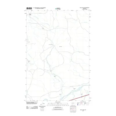
2011 Map of Kelly Hills
USGS Topo · Published 2011About this map
Kelly Hills rise above a landscape defined by ranching legacy and the winding course of the Yellowstone River in this 2011 survey of Sweet Grass County. The map provides a clear record of land ownership and homestead history, documenting sites like the Old Kelly Homestead and numerous family holdings including Boe Ranch, Fetter Ranch, and Chris Boe Ranch. These properties are tied to the complex drainage network of Duck Creek, East Fork Duck Creek, and West Fork Duck Creek, illustrating how early settlement patterns followed the available water sources in this part of Montana.
Find a feature on this map
26 named features on this map. Tap any name to fly to it.
Don’t see what you’re looking for? This feature index may not catch every label — zoom into the map to look around manually.
Map Details
Editions of this 2011 Kelly Hills Map
This is the sole edition of this map. No revisions or reprints were ever made.
Other maps of this area

1891 · Livingston
USGS Topo · 1:250,000

1893 · Livingston
USGS Topo · 1:250,000

1947 · Bozeman
USGS Topo · 1:250,000

1948 · Bozeman
USGS Topo · 1:250,000
1951 · Grosfield Ranch
USGS Topo · 1:24,000
1951 · Raspberry Butte
USGS Topo · 1:24,000

1951 · Kelly Hills
USGS Topo · 1:24,000

1951 · Springdale
USGS Topo · 1:24,000

1951 · Hunters Hot Springs
USGS Topo · 1:24,000

1951 · Elton
USGS Topo · 1:24,000