Old Maps of Sweet Grass County, Montana
Explore 361 old maps of Sweet Grass County, spanning from 1886 to today. These high-resolution historic maps reveal how streets, neighborhoods, landmarks, and natural features evolved over time — perfect for genealogy, metal detecting, research, and local history exploration.
What you can do with these maps:
- See how Sweet Grass County changed over time: Compare historical maps to modern-day views to trace roads, homesites, rail lines & more.
- View detailed metadata: Each map includes creators, publishers, year, scale, and archive source.
- Overlay maps with satellite & LiDAR: Visualize the past alongside modern tools to explore terrain & human change.
- Trusted historical sources: Maps sourced from the USGS, Library of Congress, and other archives.
- Access maps your way: View online, download high-res files, or order prints for personal or research use.
Start exploring old maps of Sweet Grass County to uncover forgotten places, hidden landmarks, and the deep history beneath your feet.
Sweet Grass County, MT maps
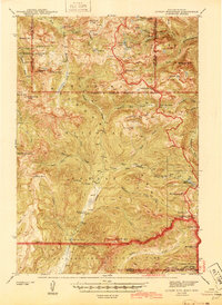
(361)- 1886 Map of Little Belt Mts.
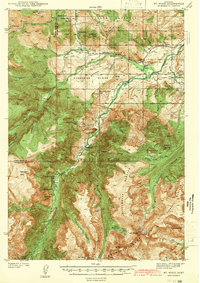
 1886 Little Belt Mts.1886 Print · USGSCentral Montana territory during the mid-1880s is captured here, showing the region's early mining camps and ranching hubs. Researchers can trace the early layouts of White Sulphur Spring and Neihart or locate landmarks like Copperopolis and Crazy Peak.
 - 1889 Map of Big Snowy Mountain
 1889 Big Snowy Mountain1889 Print · USGSCentral Montana in the late 1880s was a land of critical mountain passes and emerging frontier outposts. You can trace early settlement patterns and cattle country geography through historic sites like Ubet, Bercail, and Melville near the Musselshell River.
 - 1891 Map of Livingston
 1891 Livingston1891 Print · USGSUpper Yellowstone River country is documented here in the late nineteenth century as the railroad transformed the valley. Genealogists and historians can trace rail-stop towns like Cokedale, the military grounds at Ft. Ellis, and the Old Crow Agency.
 - 1891 Map of Big Timber
 1891 Big Timber1891 Print · USGSMontana ranching country and the Yellowstone valley are captured here in the late nineteenth century. Trace the early Northern Pacific Railroad line through Big Timber and Greycliff, or locate the Harrison Ferry crossing.
 - 1892 Map of Stillwater
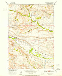
 1892 Stillwater1892 Print · USGSThe Yellowstone valley in the late nineteenth century was a corridor of rapid transition as the railroad moved westward alongside the Crow Indian Reservation. Researchers can trace early river crossings and pioneer settlements such as Merrill, Stillwater, and the Ford at Youngs Point.4 unique versions available
 - 1893 Map of Livingston
 1893 Livingston1893 Print · USGSThe Montana mountain country and the gateway to the national park are captured here in the late nineteenth century. Trace the industrial rail corridor through Livingston to mining sites like Coke and the historic Old Crow Agency.5 unique versions available
 - 1893 Map of Big Snowy Mountain
 1893 Big Snowy Mountain1893 Print · USGSCentral Montana in the late frontier era reveals a landscape shaped by the massive Big Snowy Mountain and the headwaters of major rivers. Researchers can trace early settlements and transit points like Ubet, Judith Gap, and the remote outpost of Bercail.4 unique versions available
 - 1893 Map of Big Timber
 1893 Big Timber1893 Print · USGSBig Timber and the Yellowstone valley appear here during the expansion of the rail-and-river economy in the late nineteenth century. Researchers can trace the original Northern Pacific Railroad route and locate early river crossings like Harrison Ferry and settlements at Greycliff.4 unique versions available
 - 1894 Map of Little Belt Mts.
 1894 Little Belt Mts.1894 Print · USGSCentral Montana in the late nineteenth century is a land of emerging mining camps and river valley outposts. Historians can trace the early footprints of White Sulphur Spring, the copper prospects at Copperopolis, and the mountain terrain of Neihart.2 unique versions available
 - 1897 Map of Little Belt Mts.
 1897 Little Belt Mts.1897 Print · USGSMeagher County and the central Montana high country are captured here in the 1890s, when mining camps and early ranching outposts were first being established. Researchers can trace the early layout of White Sulphur Springs and locate now-quiet sites like the Sapphire Mine or Copperopolis.
 - 1898 Map of Granite Mountain District
 1898 Granite Mountain District1898 Print · USGSThe Beartooth Range appears here in the late nineteenth century during a specialized survey for regional coal and electric companies. Researchers can trace early mountain pathways through Goose Lake Pass and locate major summits like Granite Peak and Mt Dewey.
 - 1898 Map of Little Belt Mts.
 1898 Little Belt Mts.1898 Print · USGSCentral Montana in the late nineteenth century is a landscape of mountain mining camps and early ranching outposts. Genealogists and historians can trace the pioneer footprints of White Sulphur Springs, the operations at Sapphire Mine, and the route of Sixteenmile Creek.
 - 1902 Map of Little Belt Mts.
 1902 Little Belt Mts.1902 Print · USGSMeagher County at the close of the nineteenth century is a landscape of mountain mining camps and riverside settlements. Researchers can trace early industry and family roots near the Sapphire Mine, the town of White Sulphur Springs, and the camp at Neihart.3 unique versions available
 - 1932 Map of Nye No 2
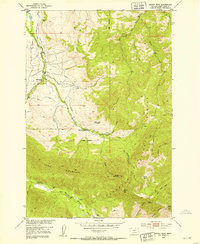
 1932 Nye No 21932 Print · USGSStillwater County’s high country comes into focus in the early 1930s, showing the early infrastructure of the national forests. Genealogists and historians can locate the Nye PO, trace the irrigation networks of Horseman Flats, and find remote landmarks like Beartooth Ranch.
 - 1939 Map of Mt Wood, 1941 Print
 1939 Mt Wood1941 Print · USGSStillwater County comes alive in the late thirties, documenting a rugged mining and ranching frontier within the Custer National Forest. Genealogists and historians can trace local landmarks like Nye, the Benbow Mine, and the Limestone Sch.4 unique versions available
 - 1941 Map of Mt. Wood
 1941 Mt. Wood1941 Print · USGSStillwater County and the Custer National Forest are mapped here in the early 1940s, showing a landscape defined by mountain mining and river valley ranching. Researchers can locate the Nye Cem, the Benbow Mine, and high-country landmarks like Beartooth Ranch.
 - 1941 Map of Mt Douglas, 1958 Print
 1941 Mt Douglas1958 Print · USGSHigh-altitude Montana ranching and resource extraction are captured here at the start of the 1940s. Genealogists and historians can trace early land use at Clydehurst Ranch, the Gish Mine, and the Fourmile Guard Station.4 unique versions available
 - 1942 Map of Cutoff Mtn, 1959 Print
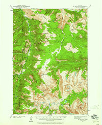
 1942 Cutoff Mtn1959 Print · USGSThe Absaroka-Beartooth wilderness along the Montana-Wyoming border is captured here in the early 1940s. Researchers can trace the high-country trails and sites like the Independence Mine, Silver Tip Ranch, and the Cooke Ranger Sta.4 unique versions available
 - 1943 Map of Mt Douglas
 1943 Mt Douglas1943 Print · USGSHigh-altitude Montana ranching and forestry are documented here in the early 1940s, before modern road networks reached these alpine basins. Researchers can locate remote outposts like Clydehurst Ranch or trace the backcountry administrative boundaries near Fourmile Guard Station and Snowy Peak.2 unique versions available
 - 1944 Map of Cutoff Mtn
 1944 Cutoff Mtn1944 Print · USGSThe northern gateway to Yellowstone and the high Absaroka wilderness are documented in the early 1940s, just as the park’s modern boundaries were being refined. Trace the historic Northeast Entrance, the remote Silver Tip Ranch, and the high-altitude Independence Mine.2 unique versions available
 - 1947 Map of Bozeman, 1948 Print
 1947 Bozeman1948 Print · USGSBozeman and the surrounding mountain ranges are captured here just after the war, showing the vital rail and river networks of southwestern Montana. Genealogists and historians can trace routes to early settlements like Virginia City, Gallatin Gateway, and the mountain community of Jardine.
 - 1948 Map of Bozeman, 1951 Print
 1948 Bozeman1951 Print · USGSSouthern Montana in the late 1940s is shown as a high-country crossroads of rail lines and river headwaters. Genealogists and historians can trace old town sites like Virginia City and McLeod alongside the Northern Pacific and Milwaukee Road railroads.
 - 1948 Map of White Sulphur Springs, 1951 Print
 1948 White Sulphur Springs1951 Print · USGSMontana's capital and the high country of the Big Belt Mountains come alive in this mid-century survey. Trace the early hydroelectric developments at Canyon Ferry Dam or follow the historic rail lines through Ringling and Townsend.
 - 1951 Map of Squaw Peak, 1953 Print
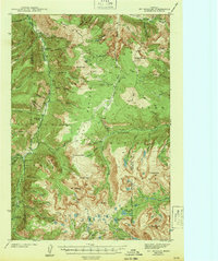
 1951 Squaw Peak1953 Print · USGSHigh mountain homesteads and remote forest ridges define this area of Sweet Grass County in the early fifties. Researchers can trace the heritage of local families and early industry through the Mc Kinsey Homestead, the East Boulder School, and the Sawmill Ruins.2 unique versions available
 - 1951 Map of Grosfield Ranch, 1953 Print
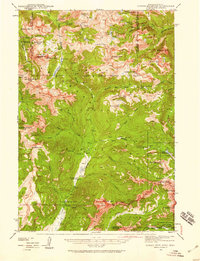
 1951 Grosfield Ranch1953 Print · USGSSweet Grass County, Montana, is captured here in the early 1950s during a period of transition for its high-country ranching families. Genealogists and historians can trace the status of family land like the Plaggemeyer Homestead or locate abandoned sites such as the Iverson Homestead and Vik Homestead.4 unique versions available
Showing maps 1-25 of 361
Top cities of Sweet Grass County
Frequently asked questions
- What are the different types of historical maps available for Sweet Grass County?
- What is the oldest map of Sweet Grass County?
- Where can I purchase historical maps of Sweet Grass County for my home or office?
- Where can I download high-res historical maps of Sweet Grass County?
- Are there historical topographic maps available for Sweet Grass County?
- Is there historical aerial imagery available for Sweet Grass County?
- Where are historical maps of Sweet Grass County sourced from?