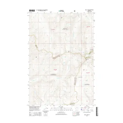
2014 Map of Kelly Lake
USGS Topo · Published 2014About this map
Bitterroot Pass serves as a high mountain crossing between the watersheds of the E Fork Bitterroot River and the Rock Creek drainage. This high-altitude wilderness area is defined by the convergence of the Anaconda Range and the borders of the Bitterroot National Forest, Deerlodge National Forest, and Beaverhead National Forest. The landscape is characterized by numerous glacial tarns, including Kelly Lake, Ivanhoe Lake, and Phyllis Lake, clustered around prominent summits like East Pintler Peak and West Pintler Peak. In the lower elevations, the E Fork Bitterroot River flows past Star Falls, while the open meadows of Elk Park offer a contrast to the dense timber. The presence of Sawed Cabin Lake and named points like Cliff Point provide valuable landmarks for tracing historic wilderness routes and forest boundaries at the start of the 21st century.
Find a feature on this map
53 named features on this map. Tap any name to fly to it.
Don’t see what you’re looking for? This feature index may not catch every label — zoom into the map to look around manually.
Map Details
Editions of this 2014 Kelly Lake Map
This is the sole edition of this map. No revisions or reprints were ever made.
Other maps of this area

1908 · Philipsburg
USGS Topo · 1:125,000

1909 · Sapphire
USGS Topo · 1:125,000

1947 · Butte
USGS Topo · 1:250,000

1955 · Dillon
USGS Topo · 1:250,000

1957 · Dillon
USGS Topo · 1:250,000

1958 · Butte
USGS Topo · 1:250,000

1958 · Dillon
USGS Topo · 1:250,000

1960 · Butte
USGS Topo · 1:250,000

1962 · Butte
USGS Topo · 1:250,000

1962 · Dillon
USGS Topo · 1:250,000