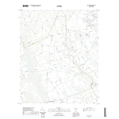
2020 Map of Kellytown
USGS Topo · Published 2020About this map
Ashland and Kellytown anchor this Darlington County landscape, where the agricultural uplands transition into a complex network of wetlands and minor tributaries. The area is defined by the expansive Sparrow Swamp and the Lynches River, which form a natural boundary between Darlington and Lee Counties. These water systems, alongside Turkey Cr and Merchants Mill Cr, have historically dictated the placement of settlements and transport routes.
Find a feature on this map
118 named features on this map. Tap any name to fly to it.
Don’t see what you’re looking for? This feature index may not catch every label — zoom into the map to look around manually.
Map Details
Editions of this 2020 Kellytown Map
This is the sole edition of this map. No revisions or reprints were ever made.
Other maps of this area

1941 · Spartanburg
USGS Topo · 1:250,000

1953 · Spartanburg
USGS Topo · 1:250,000

1957 · Ashwood
USGS Topo · 1:62,500

1960 · Spartanburg
USGS Topo · 1:250,000

1963 · Spartanburg
USGS Topo · 1:250,000

1964 · Spartanburg
USGS Topo · 1:250,000
1968 · Hartsville North
USGS Topo · 1:24,000
1968 · Lake Robinson
USGS Topo · 1:24,000

1968 · Kellytown
USGS Topo · 1:24,000
1968 · Hartsville South
USGS Topo · 1:24,000