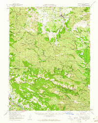
1959 Map of Kelseyville
USGS Topo · Published 1961About this map
The geothermal activity of the Mayacmas Mountains defines the southern portion of this landscape, where The Geysers (Steam Wells) and the Geysers Resort represent a unique intersection of natural energy and early tourism. Further south, the mercury mining legacy of the region is evident through clusters of extraction sites like the Culver-Bear Mine, Buckman Mines, and the Socrates Mine near the settlement of Mercuryville.
Find a feature on this map
112 named features on this map. Tap any name to fly to it.
Don’t see what you’re looking for? This feature index may not catch every label — zoom into the map to look around manually.
Map Details
Editions of this 1959 Kelseyville Map
2 editions found
Other maps of this area

1920 · Healdsburg
USGS Topo · 1:62,500

1920 · Ukiah
USGS Topo · 1:62,500

1921 · Skaggs
USGS Topo · 1:62,500

1921 · Kelseyville
USGS Topo · 1:62,500

1924 · Bartlett Springs
USGS Topo · 1:62,500

1927 · Calistoga
USGS Topo · 1:62,500

1933 · Healdsburg
USGS Topo · 1:48,000

1938 · Lakeport
USGS Topo · 1:62,500

1938 · Hopland
USGS Topo · 1:62,500

1940 · Healdsburg
USGS Topo · 1:62,500