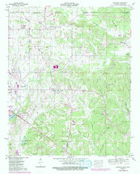
1950 Map of Kendrick
USGS Topo · Published 1992About this map
The Tennessee Valley Divide cuts through this landscape along the state border between Tennessee and Mississippi, separating the drainage systems of Sevenmile Creek and Chambers Creek from the southern creeks feeding the Gulf of Mexico. Centered on the settlement of Farmington, the terrain is defined by a network of small family-named cemeteries and rural congregations such as Fraley Chapel and Box Chapel. The 1991 revisions highlighted in purple capture the growth of Corinth on the western edge, including the Drive-in Theater and the development around Hillandale Lake.
Find a feature on this map
61 named features on this map. Tap any name to fly to it.
Don’t see what you’re looking for? This feature index may not catch every label — zoom into the map to look around manually.
Map Details
Editions of this 1950 Kendrick Map
Other maps of this area

1935 · Doskie
USGS Topo · 1:24,000

1935 · Leedy
USGS Topo · 1:24,000

1935 · Glens
USGS Topo · 1:24,000

1936 · Counce
USGS Topo · 1:24,000

1936 · Kendrick
USGS Topo · 1:24,000

1936 · Michie
USGS Topo · 1:24,000
1949 · Counce
USGS Topo · 1:24,000

1949 · Michie
USGS Topo · 1:24,000

1950 · Corinth
USGS Topo · 1:62,500

1950 · Kendrick
USGS Topo · 1:24,000