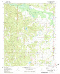
1982 Map of Kossuth North
USGS Topo · Published 1983About this map
The Tuscumbia River Canal defines the northern reaches of this Alcorn County landscape, marking the border between Tennessee and Mississippi. In the early 1980s, this rural area north of Kossuth was characterized by a dense network of creek branches and scattered family settlements. Landmarks like the Pine Mountain Lookout Tower offer a high vantage point over the undulating terrain of the McNairy and Alcorn county line.
Find a feature on this map
46 named features on this map. Tap any name to fly to it.
Don’t see what you’re looking for? This feature index may not catch every label — zoom into the map to look around manually.
Map Details
Editions of this 1982 Kossuth North Map
This is the sole edition of this map. No revisions or reprints were ever made.
Other maps of this area

1950 · Corinth
USGS Topo · 1:62,500

1950 · Pocahontas
USGS Topo · 1:24,000

1951 · Chewalla
USGS Topo · 1:24,000

1951 · Guys
USGS Topo · 1:24,000

1951 · Walnut
USGS Topo · 1:62,500

1952 · Pocahontas
USGS Topo · 1:24,000

1956 · Blytheville
USGS Topo · 1:250,000

1956 · Tupelo
USGS Topo · 1:250,000

1958 · Tupelo
USGS Topo · 1:250,000

1959 · Blytheville
USGS Topo · 1:250,000