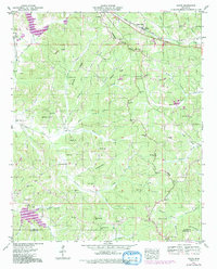
1950 Map of Glens
USGS Topo · Published 1991About this map
Jacinto stands as a focal point in this 1950 survey, located near the southern boundary of the quadrangle where Alcorn and Prentiss counties meet. The area is defined by the Tennessee Valley Divide, a topographic spine that separates the northern drainage of Coke Creek and Yellow Jacket Creek from the southern waters of Moores Creek and Reedy Branch. This divide influenced the placement of early infrastructure, including the Lee Highway which skirts the northern ridge lines near Glen.
Find a feature on this map
63 named features on this map. Tap any name to fly to it.
Don’t see what you’re looking for? This feature index may not catch every label — zoom into the map to look around manually.
Map Details
Editions of this 1950 Glens Map
3 editions found

Other maps of this area

1921 · Booneville
USGS Topo · 1:48,000

1922 · Booneville
USGS Topo · 1:62,500

1935 · Holcut
USGS Topo · 1:24,000

1935 · Doskie
USGS Topo · 1:24,000

1935 · Leedy
USGS Topo · 1:24,000

1935 · Glens
USGS Topo · 1:24,000

1936 · Kendrick
USGS Topo · 1:24,000

1950 · Corinth
USGS Topo · 1:62,500

1950 · Kendrick
USGS Topo · 1:24,000

1950 · Paden
USGS Topo · 1:24,000