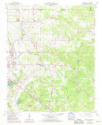
1950 Map of Kendrick
USGS Topo · Published 1971About this map
The Tennessee Divide cuts through this landscape on the border of Alcorn County, Mississippi, and McNairy County, Tennessee, separating the drainage systems of the region. Near the rail junction at Corinth, the Illinois Central Southern and the Corinth and Counce railroads facilitate the movement of goods through the agricultural backcountry. The rural character is defined by a network of community landmarks, including Oakland Sch and several country churches like Fraley Chapel and Box Chapel.
Find a feature on this map
59 named features on this map. Tap any name to fly to it.
Don’t see what you’re looking for? This feature index may not catch every label — zoom into the map to look around manually.
Map Details
Editions of this 1950 Kendrick Map
Other maps of this area

1935 · Doskie
USGS Topo · 1:24,000

1935 · Leedy
USGS Topo · 1:24,000

1935 · Glens
USGS Topo · 1:24,000

1936 · Counce
USGS Topo · 1:24,000

1936 · Kendrick
USGS Topo · 1:24,000

1936 · Michie
USGS Topo · 1:24,000
1949 · Counce
USGS Topo · 1:24,000

1949 · Michie
USGS Topo · 1:24,000

1950 · Corinth
USGS Topo · 1:62,500

1950 · Kendrick
USGS Topo · 1:24,000