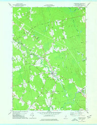
1977 Map of Kenduskeag
USGS Topo · Published 1977About this map
Kenduskeag Stream winds southeastward through this mid-1970s landscape, serving as the central artery for the village of Kenduskeag and the surrounding rural hamlets. The map documents a period of established agricultural and residential patterns in Penobscot County, where small settlements like South Corinth, Robyville, and Higginsville are connected by a network of named local roads. The landscape is characterized by a mix of low-lying wetlands, such as Beaver Meadow Brook and Marston Meadow Brook, and modest elevations like Hudson Hill.
Find a feature on this map
57 named features on this map. Tap any name to fly to it.
Don’t see what you’re looking for? This feature index may not catch every label — zoom into the map to look around manually.
Map Details
Editions of this 1977 Kenduskeag Map
2 editions found
Other maps of this area

1902 · Bangor
USGS Topo · 1:62,500

1931 · Stetson
USGS Topo · 1:48,000

1932 · Dover-Foxcroft
USGS Topo · 1:48,000

1933 · Boyd Lake
USGS Topo · 1:62,500

1935 · Dover-Foxcroft
USGS Topo · 1:62,500

1935 · Stetson
USGS Topo · 1:62,500

1942 · Bangor
USGS Topo · 1:62,500

1946 · Bangor
USGS Topo · 1:62,500

1948 · Bangor
USGS Topo · 1:250,000

1951 · Boyd Lake
USGS Topo · 1:50,000