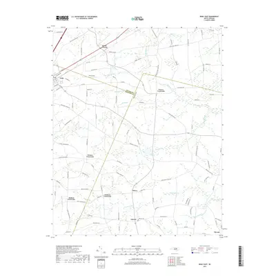
2019 Map of Kenly East
USGS Topo · Published 2019About this map
Kenly and its eastern surroundings are defined by a complex network of wetlands and agricultural intersections at the border of Johnston, Wilson, and Wayne counties. The landscape is characterized by numerous slow-moving water bodies, including Nahunta Swamp, Juniper Swamp, and Robin Swamp, which historically dictated the placement of settlements and transport routes. A series of distinct named junctions, such as Watson Crossroads, Hickory Crossroads, and Hollands Crossroads, reflect a rural development pattern where community life centered on these key transit points.
Find a feature on this map
105 named features on this map. Tap any name to fly to it.
Don’t see what you’re looking for? This feature index may not catch every label — zoom into the map to look around manually.
Map Details
Editions of this 2019 Kenly East Map
This is the sole edition of this map. No revisions or reprints were ever made.
Other maps of this area

1902 · Kenly
USGS Topo · 1:62,500

1903 · Kenly
USGS Topo · 1:62,500

1904 · Wilson
USGS Topo · 1:62,500

1953 · Rocky Mount
USGS Topo · 1:250,000

1953 · Raleigh
USGS Topo · 1:250,000

1954 · Rocky Mount
USGS Topo · 1:250,000

1954 · Raleigh
USGS Topo · 1:250,000

1957 · Goldsboro
USGS Topo · 1:62,500

1974 · Northwest Goldsboro
USGS Topo · 1:24,000
1974 · Princeton
USGS Topo · 1:24,000