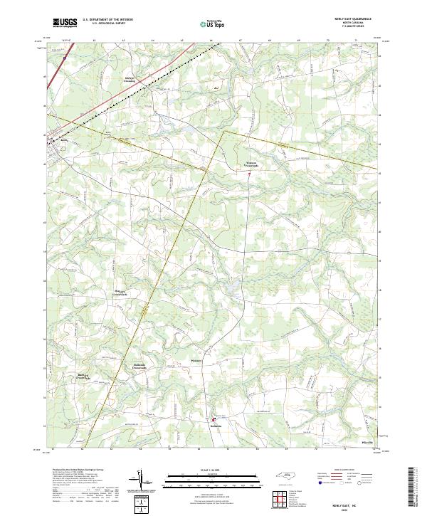
2022 Map of Kenly East
USGS Topo · Published 2022About this map
Kenly and Pikeville anchor the corners of this landscape where the borders of Wilson, Johnston, and Wayne Counties converge. The topography is defined by an intricate network of wetlands, including the sprawling Great Swamp and Nahunta Swamp, which dictate the placement of early settlements and road crossings. Numerous crossroads communities illustrate the historic rural development pattern of the North Carolina Coastal Plain, with hubs such as Watson Crossroads, Hickory Crossroads, and Radford Crossroads serving as focal points for the surrounding agricultural tracts. Local history is etched into the terrain through family-named features and landmarks like the Edgerton Cem and Kirbys Crossing. Industrial and infrastructure elements, such as the Sasser Millpond and the Kenly Airport, reflect the community's evolution over decades of shifting land use from traditional milling and farming toward more modern transportation networks.
Find a feature on this map
107 named features on this map. Tap any name to fly to it.
Don’t see what you’re looking for? This feature index may not catch every label — zoom into the map to look around manually.
Map Details
Editions of this 2022 Kenly East Map
This is the sole edition of this map. No revisions or reprints were ever made.
Other maps of this area

1902 · Kenly
USGS Topo · 1:62,500

1903 · Kenly
USGS Topo · 1:62,500

1904 · Wilson
USGS Topo · 1:62,500

1953 · Rocky Mount
USGS Topo · 1:250,000

1953 · Raleigh
USGS Topo · 1:250,000

1954 · Rocky Mount
USGS Topo · 1:250,000

1954 · Raleigh
USGS Topo · 1:250,000

1957 · Goldsboro
USGS Topo · 1:62,500

1974 · Northwest Goldsboro
USGS Topo · 1:24,000
1974 · Princeton
USGS Topo · 1:24,000