
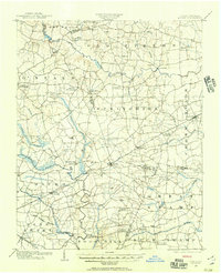
1902 Map of Kenly
USGS Topo · Published 1902About this map
Kenly stands as a central hub in this survey of the North Carolina coastal plain, where the Atlantic Coast Line railroad dictates the pattern of early 20th-century commerce. The landscape is defined by its extensive drainage systems, including the Moccasin Creek and the wide reaches of Contentnea Creek, which separate the various townships. Settlement is dense but rural, characterized by a high frequency of named junctions and family-owned landmarks.
Find a feature on this map
58 named features on this map. Tap any name to fly to it.
Don’t see what you’re looking for? This feature index may not catch every label — zoom into the map to look around manually.
Map Details
Editions of this 1902 Kenly Map
2 editions found
Other maps of this area

1902 · Rocky Mount
USGS Topo · 1:62,500

1902 · Spring Hope
USGS Topo · 1:62,500

1903 · Kenly
USGS Topo · 1:62,500

1904 · Rocky Mount
USGS Topo · 1:62,500

1904 · Springhope
USGS Topo · 1:62,500

1904 · Wilson
USGS Topo · 1:62,500

1906 · Four Oaks
USGS Topo · 1:48,000

1908 · Four Oaks
USGS Topo · 1:62,500

1953 · Rocky Mount
USGS Topo · 1:250,000

1953 · Raleigh
USGS Topo · 1:250,000