
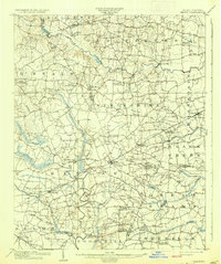
1903 Map of Kenly
USGS Topo · Published 1903About this map
Kenly stands at the center of this 1902 survey, where the Atlantic Coast Line railroad cuts a diagonal path through the tobacco and cotton country of Johnston and Wilson counties. The landscape is defined by an intricate network of wetlands and watercourses, including the meandering Contentnea Creek and the expansive Great Swamp to the southeast. These natural features dictated the early settlement patterns, forcing roads to converge at numerous named junctions such as Buckhorn Crossroads, Moores Crossroads, and Hares Crossroads.
Find a feature on this map
52 named features on this map. Tap any name to fly to it.
Don’t see what you’re looking for? This feature index may not catch every label — zoom into the map to look around manually.
Map Details
Editions of this 1903 Kenly Map
2 editions found
Other maps of this area

1902 · Kenly
USGS Topo · 1:62,500

1902 · Rocky Mount
USGS Topo · 1:62,500

1902 · Spring Hope
USGS Topo · 1:62,500

1904 · Rocky Mount
USGS Topo · 1:62,500

1904 · Springhope
USGS Topo · 1:62,500

1904 · Wilson
USGS Topo · 1:62,500

1906 · Four Oaks
USGS Topo · 1:48,000

1908 · Four Oaks
USGS Topo · 1:62,500

1953 · Rocky Mount
USGS Topo · 1:250,000

1953 · Raleigh
USGS Topo · 1:250,000