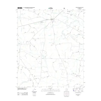
2013 Map of Kennard
USGS Topo · Published 2013About this map
Kennard serves as the central hub for this portion of Houston County, where the intersections of FM 2781 and local streets like Broadway St and Julia St define the town's layout. The landscape is deeply etched by a network of waterways, including S Fork Cochino Bayou to the north and the meandering Piney Cr through the center. Small settlements like Allen Chapel, Colthorp, and Fog Town are connected by a web of county and forest service roads. Genealogists will find a high density of burial sites including Corinth Cem, Creasy Cem, and the Kennard Community Cem. To the southeast, the Nogalus Lookout Tower stands as a notable landmark overlooking the convergence of Hager Cr and Armstrong Cr, reflecting the region's managed forest environment.
Find a feature on this map
67 named features on this map. Tap any name to fly to it.
Don’t see what you’re looking for? This feature index may not catch every label — zoom into the map to look around manually.
Map Details
Editions of this 2013 Kennard Map
This is the sole edition of this map. No revisions or reprints were ever made.
Other maps of this area

1950 · Crockett NE
USGS Topo · 1:24,000

1950 · Kennard NE
USGS Topo · 1:24,000

1950 · Ratcliff
USGS Topo · 1:24,000

1950 · Centralia
USGS Topo · 1:24,000

1951 · Kennard
USGS Topo · 1:24,000

1951 · Centralia
USGS Topo · 1:24,000

1951 · Berea
USGS Topo · 1:24,000

1951 · Crockett NE
USGS Topo · 1:24,000

1951 · Kennard NE
USGS Topo · 1:24,000

1951 · Ratcliff
USGS Topo · 1:24,000