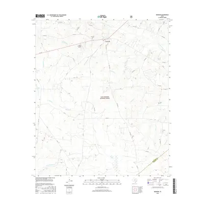
2016 Map of Kennard
USGS Topo · Published 2016About this map
The settlement of Kennard serves as the focal point of this East Texas survey, situated at the edge of the Davy Crockett National Forest. The landscape is defined by its complex hydrography, where the S Fork Cochino Bayou and Piney Cr weave through the piney woods. Genealogists will find significant value in the distribution of family and community burial grounds scattered across the terrain, including Corinth Cem, New Hope Cem, and Antioch Cem. The rural infrastructure is characterized by a network of farm-to-market roads like FM 2781 and FM 1733, which connect small homesteads and the Flying S Ranch Airport to the larger region. The map also delineates the boundary between Houston and Trinity counties in the southeast corner, following the course of Armstrong Cr and E Fork White Rock Cr.
Find a feature on this map
53 named features on this map. Tap any name to fly to it.
Don’t see what you’re looking for? This feature index may not catch every label — zoom into the map to look around manually.
Map Details
Editions of this 2016 Kennard Map
This is the sole edition of this map. No revisions or reprints were ever made.
Other maps of this area

1950 · Crockett NE
USGS Topo · 1:24,000

1950 · Kennard NE
USGS Topo · 1:24,000

1950 · Ratcliff
USGS Topo · 1:24,000

1950 · Centralia
USGS Topo · 1:24,000

1951 · Kennard
USGS Topo · 1:24,000

1951 · Centralia
USGS Topo · 1:24,000

1951 · Berea
USGS Topo · 1:24,000

1951 · Crockett NE
USGS Topo · 1:24,000

1951 · Kennard NE
USGS Topo · 1:24,000

1951 · Ratcliff
USGS Topo · 1:24,000