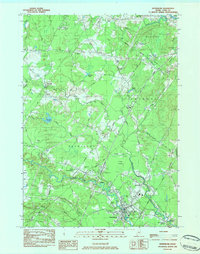
1983 Map of Kennebunk
USGS Topo · Published 1984About this map
The Mousam River and Kennebunk River dictate the settlement patterns of this coastal Maine region as it appeared in the early 1980s. The town of Kennebunk serves as the primary hub, while smaller historical hamlets like West Kennebunk, Alewife, and Kennebunk Landing reveal the distributed nature of local commerce. Industry and transport are well-defined by the path of the Boston and Maine Railroad and the Maine Turnpike, which intersect near Bartlett Mills. Local genealogy is anchored by several well-documented burial grounds including Hope Cem, Pine Grove Cem, and Russell Cem. To the north, the landscape transitions toward Lyman and Arundel, marked by numerous water bodies like Brimstone Pond and Alewife Pond. This survey provides a clear view of the area's transition from a water-powered mill economy, suggested by names like Days Mill, into a modern residential and transit corridor.
Find a feature on this map
58 named features on this map. Tap any name to fly to it.
Don’t see what you’re looking for? This feature index may not catch every label — zoom into the map to look around manually.
Map Details
Editions of this 1983 Kennebunk Map
2 editions found
Other maps of this area

1891 · Portland
USGS Topo · 1:62,500

1891 · Biddeford
USGS Topo · 1:62,500

1891 · Kennebunk
USGS Topo · 1:62,500

1891 · Buxton
USGS Topo · 1:62,500

1892 · Buxton
USGS Topo · 1:62,500

1893 · Kennebunk
USGS Topo · 1:62,500

1893 · Biddeford
USGS Topo · 1:62,500

1893 · Portland
USGS Topo · 1:62,500

1893 · Buxton
USGS Topo · 1:62,500

1898 · Kennebunk
USGS Topo · 1:62,500