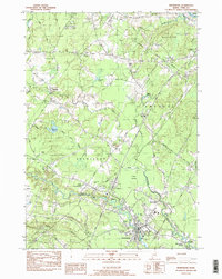
1983 Map of Kennebunk
USGS Topo · Published 1988About this map
The town of Kennebunk and its outlying villages serve as the centerpiece of this 1980s coastal Maine survey, which illustrates a landscape defined by its river systems and industrial corridors. The Mousam River and Kennebunk River wind through the region, supporting clusters of development like West Kennebunk and Bartlett Mills. In the west, the flat expanse of The Plains contrasts with the wetland of Punky Swamp, while the Maine Turnpike bisects the quadrangle, marking the era's primary transportation artery alongside the historic Boston and Maine Railroad line. The map records several family-associated landmarks and sites of local importance, including Days Mill, Alewife, and numerous burial grounds such as Hope Cem and Pine Grove Cem. These features, alongside scattered gravel pits and the Radio Facility, reflect the area's transition between its rural milling origins and its role as a modern residential and transit hub.
Find a feature on this map
45 named features on this map. Tap any name to fly to it.
Don’t see what you’re looking for? This feature index may not catch every label — zoom into the map to look around manually.
Map Details
Editions of this 1983 Kennebunk Map
2 editions found
Other maps of this area

1891 · Portland
USGS Topo · 1:62,500

1891 · Biddeford
USGS Topo · 1:62,500

1891 · Kennebunk
USGS Topo · 1:62,500

1891 · Buxton
USGS Topo · 1:62,500

1892 · Buxton
USGS Topo · 1:62,500

1893 · Kennebunk
USGS Topo · 1:62,500

1893 · Biddeford
USGS Topo · 1:62,500

1893 · Portland
USGS Topo · 1:62,500

1893 · Buxton
USGS Topo · 1:62,500

1898 · Kennebunk
USGS Topo · 1:62,500