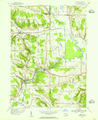
1954 Map of Kennedy
USGS Topo · Published 1955About this map
Kennedy and the surrounding drainage of Conewango Creek define this mid-1950s landscape at the boundary of Chautauqua and Cattaraugus Counties. The area is characterized by a network of upland hills, including Bentley Hill and Button Hill, which overlook a valley floor carved by numerous waterways like Clear Creek and Dry Brook. The Erie RR provides a clear industrial spine through the terrain, connecting small hubs such as Waterboro and Conewango Valley.
Find a feature on this map
51 named features on this map. Tap any name to fly to it.
Don’t see what you’re looking for? This feature index may not catch every label — zoom into the map to look around manually.
Map Details
Editions of this 1954 Kennedy Map
3 editions found
Other maps of this area

1900 · Cherry Creek
USGS Topo · 1:62,500

1905 · Jamestown
USGS Topo · 1:62,500

1922 · Randolph
USGS Topo · 1:62,500

1923 · Randolph
USGS Topo · 1:62,500

1923 · Cattaraugus
USGS Topo · 1:62,500

1938 · Cattaraugus
USGS Topo · 1:62,500

1941 · Cattaraugus
USGS Topo · 1:62,500

1941 · Cherry Creek
USGS Topo · 1:62,500

1942 · Jamestown
USGS Topo · 1:62,500

1943 · Randolph
USGS Topo · 1:62,500