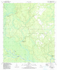
1990 Map of Kennedy Creek
USGS Topo · Published 1990About this map
The Apalachicola National Forest dominates this landscape, where the confluence of the Apalachicola River and the Chipola River creates a complex network of wetlands and riverine features. The presence of Kennedy Creek Fish Camp, White Oak Landing, and Cotton Landing highlights a local economy and recreational culture deeply tied to these waterways. Navigational points such as the Inland Waterway and the Cutoff Island demonstrate the area's importance for river transit. Moving inland from the banks, the terrain is defined by numerous sloughs and bays, including Alligator Slough and the evocatively named Styx River. Small-scale features like a Cem and Sandpit offer specific touchpoints for local history and land use, while Battle Bend marks a significant curve in the river's path south toward the gulf.
Find a feature on this map
39 named features on this map. Tap any name to fly to it.
Don’t see what you’re looking for? This feature index may not catch every label — zoom into the map to look around manually.
Map Details
Editions of this 1990 Kennedy Creek Map
This is the sole edition of this map. No revisions or reprints were ever made.
Other maps of this area

1944 · White City
USGS Topo · 1:24,000

1944 · Forbes Island
USGS Topo · 1:24,000

1945 · Dead Lake
USGS Topo · 1:31,680

1945 · Forbes Island
USGS Topo · 1:31,680

1945 · Kennedy Creek
USGS Topo · 1:31,680

1945 · White City
USGS Topo · 1:31,680

1945 · Orange
USGS Topo · 1:31,680

1945 · Wewahitchka
USGS Topo · 1:31,680

1945 · Fort Gadsden
USGS Topo · 1:31,680

1946 · Sumatra
USGS Topo · 1:31,680