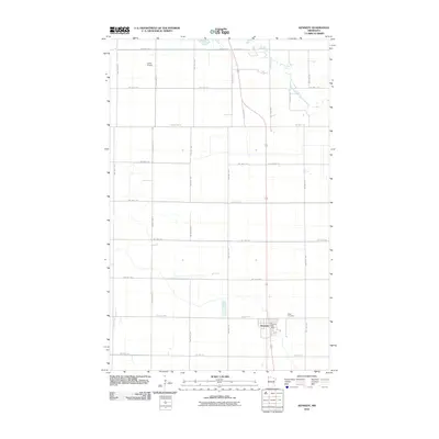
2010 Map of Kennedy
USGS Topo · Published 2010About this map
Kennedy stands as the primary hub of this Red River Valley landscape, situated along a prominent north-south rail and highway corridor. This 2010 survey by the U.S. Geological Survey shows a strictly gridded agricultural region defined by an extensive network of township roads, such as TWP HWY T-103 and TWP HWY T-84, which service the surrounding farmlands. The town itself is anchored by the Kennedy Post Office and the nearby Hope Cemetery to the east. The natural drainage of the South Branch Two Rivers meanders through the eastern sections, providing a stark contrast to the rigid geometry of the section lines and the landing strip at Lukes Airport in the northwest. This map reflects the enduring rural structure of Kittson County, where the infrastructure is built almost entirely around the needs of large-scale agriculture and regional transport.
Find a feature on this map
34 named features on this map. Tap any name to fly to it.
Don’t see what you’re looking for? This feature index may not catch every label — zoom into the map to look around manually.
Map Details
Editions of this 2010 Kennedy Map
This is the sole edition of this map. No revisions or reprints were ever made.
Other maps of this area

1939 · Drayton
USGS Topo · 1:62,500

1939 · Pembina
USGS Topo · 1:62,500

1939 · Kennedy
USGS Topo · 1:62,500

1941 · Kennedy
USGS Topo · 1:62,500

1941 · Drayton
USGS Topo · 1:62,500

1941 · Hallock
USGS Topo · 1:62,500

1941 · Pembina
USGS Topo · 1:62,500

1952 · Thief River Falls
USGS Topo · 1:250,000

1956 · Thief River Falls
USGS Topo · 1:250,000

1957 · Thief River Falls
USGS Topo · 1:250,000