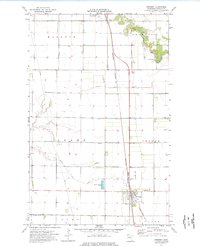
1974 Map of Kennedy
USGS Topo · Published 1976About this map
Kennedy stands as the primary rail-side settlement in this Kittson County landscape, established along the Burlington Northern line. The town's organization is reflected in nearby community landmarks like Hope Cem and the local Sewage Disposal Ponds, while the broader agricultural territory is partitioned into the townships of Hallock, Skane, Tegner, Svea, and Davis.
Find a feature on this map
18 named features on this map. Tap any name to fly to it.
Don’t see what you’re looking for? This feature index may not catch every label — zoom into the map to look around manually.
Map Details
Editions of this 1974 Kennedy Map
This is the sole edition of this map. No revisions or reprints were ever made.
Other maps of this area

1939 · Drayton
USGS Topo · 1:62,500

1939 · Pembina
USGS Topo · 1:62,500

1939 · Kennedy
USGS Topo · 1:62,500

1941 · Kennedy
USGS Topo · 1:62,500

1941 · Drayton
USGS Topo · 1:62,500

1941 · Hallock
USGS Topo · 1:62,500

1941 · Pembina
USGS Topo · 1:62,500

1952 · Thief River Falls
USGS Topo · 1:250,000

1956 · Thief River Falls
USGS Topo · 1:250,000

1957 · Thief River Falls
USGS Topo · 1:250,000