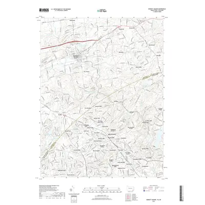
2019 Map of Kennett Square
USGS Topo · Published 2019About this map
Kennett Square anchors this detailed survey of the Pennsylvania-Delaware border region, where the historic landscape of Chester and New Castle counties meets. The area is characterized by a dense network of suburban and rural roads, including Baltimore Pike and Street Rd, connecting established settlements like Hockessin and Yorklyn. Local heritage is preserved in several significant burial sites, such as the Kennett Friends Burial Ground and Saint Patrick Cem. The hydrology is defined by the winding paths of Red Clay Creek and its many tributaries like W Br Red Clay Cr and Burrows Run, which once powered the local milling industry at sites like Burnt Mills. Terrain features like Horseshoe Hill and Mount Cuba rise above the valleys, while contemporary residential developments such as Quaker Hill and Highland Meadows illustrate the area's continued growth and settlement patterns.
Find a feature on this map
264 named features on this map. Tap any name to fly to it.
Don’t see what you’re looking for? This feature index may not catch every label — zoom into the map to look around manually.
Map Details
Editions of this 2019 Kennett Square Map
This is the sole edition of this map. No revisions or reprints were ever made.
Other maps of this area

1898 · Elkton
USGS Topo · 1:62,500

1900 · Elkton
USGS Topo · 1:62,500

1901 · West Chester
USGS Topo · 1:62,500

1904 · West Chester
USGS Topo · 1:62,500

1904 · Coatesville
USGS Topo · 1:62,500

1904 · Wilmington
USGS Topo · 1:62,500

1906 · Coatesville
USGS Topo · 1:62,500

1906 · Wilmington
USGS Topo · 1:62,500

1917 · Elkton
USGS Topo · 1:62,500

1918 · Coatesville
USGS Topo · 1:62,500
Featured Places
- Hockessin, DE
- New Garden Township, PA
- Kennett Square, PA
- Willowdale, East Marlborough Township
- Pennsbury Township, PA