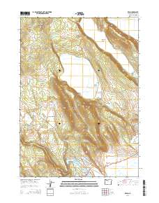
2014 Map of Keno
USGS Topo · Published 2014About this map
Keno sits at a strategic crossing of the Klamath River in this 2014 topographical study of southwestern Klamath County. The settlement is anchored by the Keno Bridge, where Or-66 meets a network of local roads like Old Wagon Rd and Stagecoach Rd, hinting at the area's historical role as a transit point. To the north, the landscape is defined by the prominent Indian Spring Ridge and the broad Long Lake Valley, while the Wocus Drainage Canal illustrates the managed hydrology of the region's agricultural basins.
Find a feature on this map
47 named features on this map. Tap any name to fly to it.
Don’t see what you’re looking for? This feature index may not catch every label — zoom into the map to look around manually.
Map Details
Editions of this 2014 Keno Map
This is the sole edition of this map. No revisions or reprints were ever made.
Other maps of this area

1889 · Klamath
USGS Topo · 1:250,000

1891 · Ashland
USGS Topo · 1:250,000

1893 · Ashland
USGS Topo · 1:250,000

1894 · Klamath
USGS Topo · 1:250,000

1897 · Ashland
USGS Topo · 1:250,000

1955 · Lake O' Woods
USGS Topo · 1:62,500

1955 · Surveyor Mtn
USGS Topo · 1:62,500

1955 · Klamath Falls
USGS Topo · 1:250,000

1955 · Medford
USGS Topo · 1:250,000

1957 · Medford
USGS Topo · 1:250,000