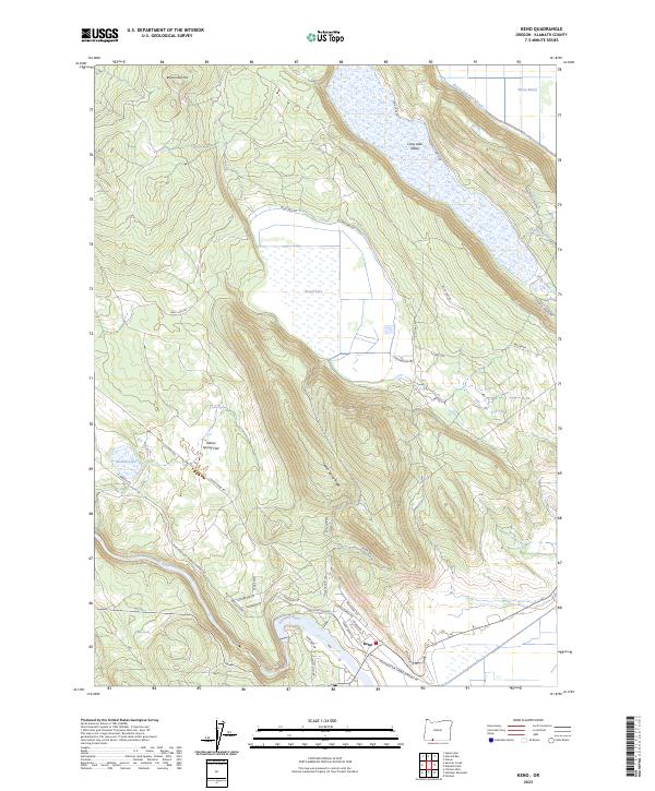
2023 Map of Keno
USGS Topo · Published 2023About this map
The Klamath River carves through the southern landscape of this 2023 survey, anchoring the settlement of Keno. The terrain is defined by a series of distinct upland flats and ridges, including Indian Spring Flat and Indian Spring Ridge, which transition into the expansive Long Lake Valley to the northeast. This modern map reveals a complex interface between natural hydrology and timber industry infrastructure, most notably the Weyerhaeuser Timber Company Rd winding alongside the river.
Find a feature on this map
46 named features on this map. Tap any name to fly to it.
Don’t see what you’re looking for? This feature index may not catch every label — zoom into the map to look around manually.
Map Details
Editions of this 2023 Keno Map
This is the sole edition of this map. No revisions or reprints were ever made.
Other maps of this area

1889 · Klamath
USGS Topo · 1:250,000

1891 · Ashland
USGS Topo · 1:250,000

1893 · Ashland
USGS Topo · 1:250,000

1894 · Klamath
USGS Topo · 1:250,000

1897 · Ashland
USGS Topo · 1:250,000

1955 · Lake O' Woods
USGS Topo · 1:62,500

1955 · Surveyor Mtn
USGS Topo · 1:62,500

1955 · Klamath Falls
USGS Topo · 1:250,000

1955 · Medford
USGS Topo · 1:250,000

1957 · Medford
USGS Topo · 1:250,000