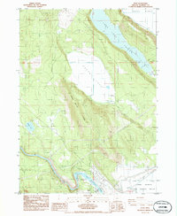
1985 Map of Keno
USGS Topo · Published 1986About this map
The Klamath River flows through the southern portion of this landscape, where the Keno Dam and its associated Fish Ladder manage the waters of the Keno Reservoir. The community of Keno is established near the riverbanks, serving as a focal point for the surrounding agricultural and wildlands. The terrain is defined by a series of north-south valleys and ridges, including the Long Lake Valley and Indian Spring Ridge.
Find a feature on this map
34 named features on this map. Tap any name to fly to it.
Don’t see what you’re looking for? This feature index may not catch every label — zoom into the map to look around manually.
Map Details
Editions of this 1985 Keno Map
This is the sole edition of this map. No revisions or reprints were ever made.
Other maps of this area

1889 · Klamath
USGS Topo · 1:250,000

1891 · Ashland
USGS Topo · 1:250,000

1893 · Ashland
USGS Topo · 1:250,000

1894 · Klamath
USGS Topo · 1:250,000

1897 · Ashland
USGS Topo · 1:250,000

1955 · Lake O' Woods
USGS Topo · 1:62,500

1955 · Surveyor Mtn
USGS Topo · 1:62,500

1955 · Klamath Falls
USGS Topo · 1:250,000

1955 · Medford
USGS Topo · 1:250,000

1957 · Medford
USGS Topo · 1:250,000