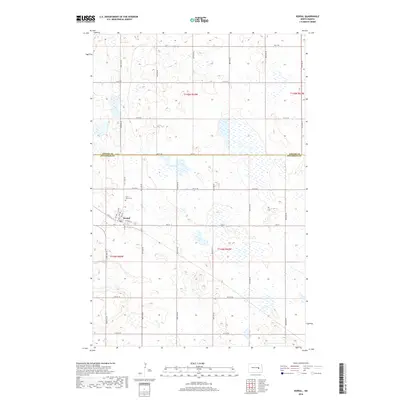
2018 Map of Kensal
USGS Topo · Published 2018About this map
The small town of Kensal serves as the focal point of this North Dakota prairie landscape, situated near the boundary where Foster Co meets Stutsman Co. This 2018 survey documents a region defined by its rigid section lines and a high density of wetlands and small water bodies that pocket the terrain. Local history is anchored by Saint Johns Cem and the residential grid of the town, featuring named corridors like Church St and 500 St. The surrounding countryside is remarkably open, with a network of rural roads such as 83rd Ave SE and 10th St SE providing access to the vast agricultural sections. The map preserves the specific drainage and moisture patterns of the era, reflecting the modern hydrological character of the northern Great Plains.
Find a feature on this map
26 named features on this map. Tap any name to fly to it.
Don’t see what you’re looking for? This feature index may not catch every label — zoom into the map to look around manually.
Map Details
Editions of this 2018 Kensal Map
This is the sole edition of this map. No revisions or reprints were ever made.
Other maps of this area

1900 · Pingree
USGS Topo · 1:125,000

1900 · Pingree
USGS Topo · 1:62,500

1951 · Bordulac NE
USGS Topo · 1:24,000

1951 · Arrowwood Lake
USGS Topo · 1:24,000

1951 · Kensal
USGS Topo · 1:24,000

1951 · Kensal NW
USGS Topo · 1:24,000

1951 · Courtenay
USGS Topo · 1:24,000

1951 · Kensal SE
USGS Topo · 1:24,000

1951 · Glenfield
USGS Topo · 1:24,000

1952 · Jim Lake
USGS Topo · 1:24,000