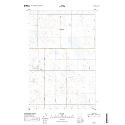
2020 Map of Kensal
USGS Topo · Published 2020About this map
The small prairie settlement of Kensal serves as the focal point of this rural North Dakota landscape, situated at the intersection of agricultural grid roads and the historic Soo Line railroad. This modern survey illustrates the enduring layout of the town, where local heritage is preserved at the Saint Johns Cem and Kensal Cem just north and west of the main residential blocks. The surrounding terrain is defined by a dense network of seasonal wetlands and small water bodies that pocket the sections between 83rd Ave SE and 90th Ave SE, revealing the natural prairie pothole geography of the region. This mosaic of land and water is bisected by the county boundary between Foster and Stutsman Counties, illustrating how historical political lines overlay the local hydrology.
Find a feature on this map
28 named features on this map. Tap any name to fly to it.
Don’t see what you’re looking for? This feature index may not catch every label — zoom into the map to look around manually.
Map Details
Editions of this 2020 Kensal Map
This is the sole edition of this map. No revisions or reprints were ever made.
Other maps of this area

1900 · Pingree
USGS Topo · 1:125,000

1900 · Pingree
USGS Topo · 1:62,500

1951 · Bordulac NE
USGS Topo · 1:24,000

1951 · Arrowwood Lake
USGS Topo · 1:24,000

1951 · Kensal
USGS Topo · 1:24,000

1951 · Kensal NW
USGS Topo · 1:24,000

1951 · Courtenay
USGS Topo · 1:24,000

1951 · Kensal SE
USGS Topo · 1:24,000

1951 · Glenfield
USGS Topo · 1:24,000

1952 · Jim Lake
USGS Topo · 1:24,000