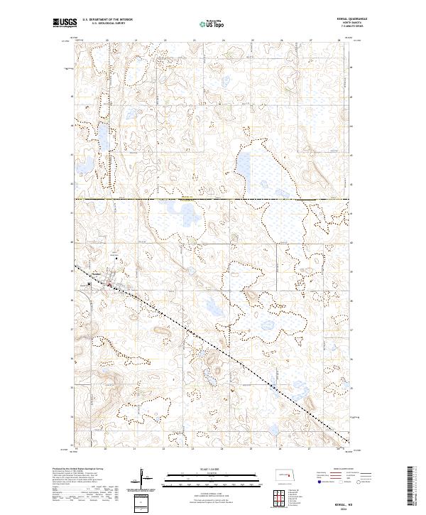
2024 Map of Kensal
USGS Topo · Published 2024About this map
Kensal serves as the primary hub of this eastern North Dakota prairie landscape, situated where the Soo Line railroad cuts diagonally across the township grid. The settlement's layout is defined by its rail history, with streets like Soo St and Church St mirroring the transit corridor. Just outside the main town site, Saint Johns Cem and Kensal Cem provide significant points of interest for genealogists tracing early families in the region. The map also delineates the boundary between Foster Co and Stutsman Co, marked by 6th St. This area is characterized by a dense network of sectional roads and numerous small wetlands and depressions typical of the Missouri Coteau region, illustrating the persistent grid-based development of the northern plains.
Find a feature on this map
29 named features on this map. Tap any name to fly to it.
Don’t see what you’re looking for? This feature index may not catch every label — zoom into the map to look around manually.
Map Details
Editions of this 2024 Kensal Map
This is the sole edition of this map. No revisions or reprints were ever made.
Other maps of this area

1900 · Pingree
USGS Topo · 1:125,000

1900 · Pingree
USGS Topo · 1:62,500

1951 · Bordulac NE
USGS Topo · 1:24,000

1951 · Arrowwood Lake
USGS Topo · 1:24,000

1951 · Kensal
USGS Topo · 1:24,000

1951 · Kensal NW
USGS Topo · 1:24,000

1951 · Courtenay
USGS Topo · 1:24,000

1951 · Kensal SE
USGS Topo · 1:24,000

1951 · Glenfield
USGS Topo · 1:24,000

1952 · Jim Lake
USGS Topo · 1:24,000