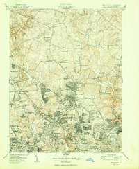
1951 Map of Kensington
USGS Topo · Published 1951About this map
The rolling hills of Montgomery County show the rapid post-war expansion of suburban Maryland, with residential developments like Viers Mill Village and Glenmont Forest rising between established crossroads. The Baltimore and Ohio RR cuts through the landscape, anchoring the towns of Kensington and Garrett Park while providing a transport spine that connects these growing communities to the broader region. This era is defined by a significant institutional presence, featuring the Army Medical Center, the Naval Medical Center, and the Johns Hopkins Laboratory.
Find a feature on this map
122 named features on this map. Tap any name to fly to it.
Don’t see what you’re looking for? This feature index may not catch every label — zoom into the map to look around manually.
Map Details
Editions of this 1951 Kensington Map
2 editions found
Other maps of this area

1890 · Mt. Vernon
USGS Topo · 1:125,000

1891 · Mt. Vernon
USGS Topo · 1:125,000

1892 · Laurel
USGS Topo · 1:62,500

1893 · Frederick
USGS Topo · 1:125,000

1894 · Laurel
USGS Topo · 1:62,500

1894 · Frederick
USGS Topo · 1:125,000

1894 · Mt. Vernon
USGS Topo · 1:125,000

1897 · Laurel
USGS Topo · 1:62,500

1897 · Mt. Vernon
USGS Topo · 1:125,000

1899 · Patuxent
USGS Topo · 1:125,000