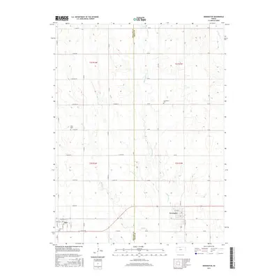
2015 Map of Kensington
USGS Topo · Published 2015About this map
The town of Kensington and the nearby village of Agra anchor this rural landscape along the boundary of Phillips and Smith Counties. Set within a grid of section roads like E Osage RD and E Plains RD, the area is defined by the subtle drainages of Middle Cedar Cr, W Cedar Cr, and E Cedar Cr. The town sites are concentrated along a transit corridor that includes Railroad Ave and Kansas Ave, reflecting the historic dependence on the rail line for moving agricultural goods from the surrounding plains.
Find a feature on this map
34 named features on this map. Tap any name to fly to it.
Don’t see what you’re looking for? This feature index may not catch every label — zoom into the map to look around manually.
Map Details
Editions of this 2015 Kensington Map
This is the sole edition of this map. No revisions or reprints were ever made.
Other maps of this area

1893 · Smith Center
USGS Topo · 1:125,000

1893 · Phillipsburg
USGS Topo · 1:125,000

1955 · Beloit
USGS Topo · 1:250,000

1959 · Beloit
USGS Topo · 1:250,000

1972 · Kirwin
USGS Topo · 1:24,000

1972 · Kirwin Reservoir
USGS Topo · 1:24,000

1973 · Kensington
USGS Topo · 1:24,000

1973 · Athol
USGS Topo · 1:24,000

1973 · Kensington NE
USGS Topo · 1:24,000
1973 · Cedar
USGS Topo · 1:24,000