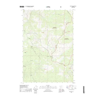
2020 Map of Kent Peak
USGS Topo · Published 2020About this map
Kent Peak stands at the center of this high-elevation mountain terrain where the boundaries of Bitterroot National Forest and Deerlodge National Forest meet. The landscape is defined by the prominent Bitterroot-Rock Creek Divide, which serves as a natural barrier between watersheds and marks the border between Ravalli and Granite counties. This divide separates the drainages of Skalkaho Creek and Sleeping Child Creek to the west from the Ross Fork system to the east.
Find a feature on this map
51 named features on this map. Tap any name to fly to it.
Don’t see what you’re looking for? This feature index may not catch every label — zoom into the map to look around manually.
Map Details
Editions of this 2020 Kent Peak Map
This is the sole edition of this map. No revisions or reprints were ever made.
Other maps of this area

1909 · Sapphire
USGS Topo · 1:125,000

1947 · Butte
USGS Topo · 1:250,000

1955 · Dillon
USGS Topo · 1:250,000

1957 · Dillon
USGS Topo · 1:250,000

1958 · Butte
USGS Topo · 1:250,000

1958 · Dillon
USGS Topo · 1:250,000

1960 · Butte
USGS Topo · 1:250,000

1962 · Butte
USGS Topo · 1:250,000

1962 · Dillon
USGS Topo · 1:250,000

1965 · Dillon
USGS Topo · 1:250,000