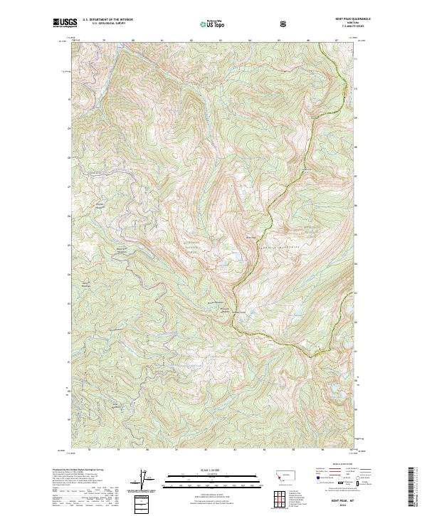
2024 Map of Kent Peak
USGS Topo · Published 2024About this map
Kent Peak and Fox Peak stand as prominent landmarks within the high-elevation terrain of the Sapphire Mountains, where the boundary between Bitterroot National Forest and Deerlodge National Forest follows the jagged ridgelines. This alpine landscape is defined by a series of glacial cirques and high-altitude basins that hold a chain of named water bodies, including Charity Lake, Faith Lake, and Hope Lake in the southeast.
Find a feature on this map
51 named features on this map. Tap any name to fly to it.
Don’t see what you’re looking for? This feature index may not catch every label — zoom into the map to look around manually.
Map Details
Editions of this 2024 Kent Peak Map
This is the sole edition of this map. No revisions or reprints were ever made.
Other maps of this area

1909 · Sapphire
USGS Topo · 1:125,000

1947 · Butte
USGS Topo · 1:250,000

1955 · Dillon
USGS Topo · 1:250,000

1957 · Dillon
USGS Topo · 1:250,000

1958 · Butte
USGS Topo · 1:250,000

1958 · Dillon
USGS Topo · 1:250,000

1960 · Butte
USGS Topo · 1:250,000

1962 · Butte
USGS Topo · 1:250,000

1962 · Dillon
USGS Topo · 1:250,000

1965 · Dillon
USGS Topo · 1:250,000