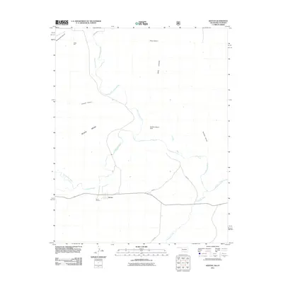
2011 Map of Kenton
USGS Topo · Published 2011About this map
Black Mesa dominates the northern landscape of this Oklahoma Panhandle border region, where the state lines of Oklahoma and Colorado meet. The settlement of Kenton sits along the southern banks of the Cimarron River, serving as a primary point of human activity in an area defined by deep drainages and volcanic plateaus. To the north, the terrain is carved by Blacksmith Canyon and Tharp Canyon, while the prominent Robbers Roost Peak stands as a landmark above the creek valleys.
Find a feature on this map
19 named features on this map. Tap any name to fly to it.
Don’t see what you’re looking for? This feature index may not catch every label — zoom into the map to look around manually.
Map Details
Editions of this 2011 Kenton Map
This is the sole edition of this map. No revisions or reprints were ever made.
Other maps of this area

1891 · Springfield
USGS Topo · 1:125,000

1892 · Mt Carrizo
USGS Topo · 1:125,000

1893 · Springfield
USGS Topo · 1:125,000

1954 · Dalhart
USGS Topo · 1:250,000

1955 · La Junta
USGS Topo · 1:250,000

1958 · La Junta
USGS Topo · 1:250,000

1958 · Dalhart
USGS Topo · 1:250,000

1962 · Dalhart
USGS Topo · 1:250,000

1968 · La Junta
USGS Topo · 1:250,000

1968 · Kenton
USGS Topo · 1:24,000