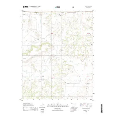
2018 Map of Kenton
USGS Topo · Published 2018About this map
The settlement of Kenton sits at the junction of several drainage systems in the Oklahoma Panhandle, providing a window into the remote geography where the Great Plains meet the foothills of the Rockies. To the north, the Comanche National Grassland spans across the border into Colorado, emphasizing the trans-border nature of this landscape. The terrain is defined by deep incisions like Blacksmith Canyon and Burrows Canyon, which cut through the high tablelands. Landmarks such as Black Mesa and Robbers Roost Peak overlook the winding courses of the Cimarron River and Dry Cimarron River. For genealogists and local historians, the Kenton Cem and the surrounding network of section roads like e0075 RD offer specific points of reference for tracing family roots in this corner of Cimarron County, where geological features like Independence Arch have stood for generations.
Find a feature on this map
30 named features on this map. Tap any name to fly to it.
Don’t see what you’re looking for? This feature index may not catch every label — zoom into the map to look around manually.
Map Details
Editions of this 2018 Kenton Map
This is the sole edition of this map. No revisions or reprints were ever made.
Other maps of this area

1891 · Springfield
USGS Topo · 1:125,000

1892 · Mt Carrizo
USGS Topo · 1:125,000

1893 · Springfield
USGS Topo · 1:125,000

1954 · Dalhart
USGS Topo · 1:250,000

1955 · La Junta
USGS Topo · 1:250,000

1958 · La Junta
USGS Topo · 1:250,000

1958 · Dalhart
USGS Topo · 1:250,000

1962 · Dalhart
USGS Topo · 1:250,000

1968 · La Junta
USGS Topo · 1:250,000

1968 · Kenton
USGS Topo · 1:24,000