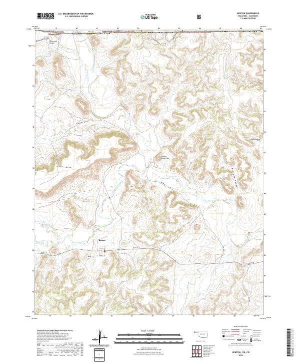
2022 Map of Kenton
USGS Topo · Published 2022About this map
The community of Kenton sits at the base of the distinctive Black Mesa, marking a unique point where the high plains of the Oklahoma Panhandle meet the rugged canyons of the Colorado border. This modern survey illustrates the complex drainage network of the Cimarron River and the Dry Cimarron River, which are fed by numerous tributaries such as N Carrizo Cr and Tesequite Cr. The landscape is defined by its topographic extremes, from the plateau of the mesa to prominent landmarks like Robbers Roost Peak and Independence Arch.
Find a feature on this map
31 named features on this map. Tap any name to fly to it.
Don’t see what you’re looking for? This feature index may not catch every label — zoom into the map to look around manually.
Map Details
Editions of this 2022 Kenton Map
This is the sole edition of this map. No revisions or reprints were ever made.
Other maps of this area

1891 · Springfield
USGS Topo · 1:125,000

1892 · Mt Carrizo
USGS Topo · 1:125,000

1893 · Springfield
USGS Topo · 1:125,000

1954 · Dalhart
USGS Topo · 1:250,000

1955 · La Junta
USGS Topo · 1:250,000

1958 · La Junta
USGS Topo · 1:250,000

1958 · Dalhart
USGS Topo · 1:250,000

1962 · Dalhart
USGS Topo · 1:250,000

1968 · La Junta
USGS Topo · 1:250,000

1968 · Kenton
USGS Topo · 1:24,000